These platforms know the road. They do not know the load.
TomTom, HERE, PTV Group, Trimble MAPS and Azure Maps between them hold the best commercial vehicle road data in the world. Every one of them takes weight as something you already know.
Five platforms
13 capabilities checked
Public documentation, August 2026
What the category is for
A road a large vehicle can physically and legally take.
This is a hard problem and these platforms solve it well. Nothing on this page is an argument that they do not.
A road network that understands trucks is an enormous piece of work. Every bridge needs a clearance, every structure needs a rating, every municipality has streets a 53-foot trailer is not allowed to turn into, and all of it changes. The platforms in this category maintain that, continuously, across whole continents. A fleet trying to build it in-house would be doing nothing else for years.
The way they all work is the same in one important respect. You describe the vehicle — height, width, length, gross weight, sometimes weight per axle, sometimes a hazardous cargo class — and the service returns a road that respects those figures. The vehicle description is an input. It is your responsibility, and the service takes it on trust.
That is the correct design for a routing service. It is also where trouble starts for a carrier. Most fleets put the gross weight from the bill of lading in that field. Enforcement cares about what each axle group carries after the freight is positioned.
Two loads of identical gross weight can be two completely different trucks. A road network cannot tell them apart. A scale can.
The input problem, in one line
A routing service asks you what the truck weighs. Every overweight citation in this category starts with a confident, well-meant, incorrect answer to that question.
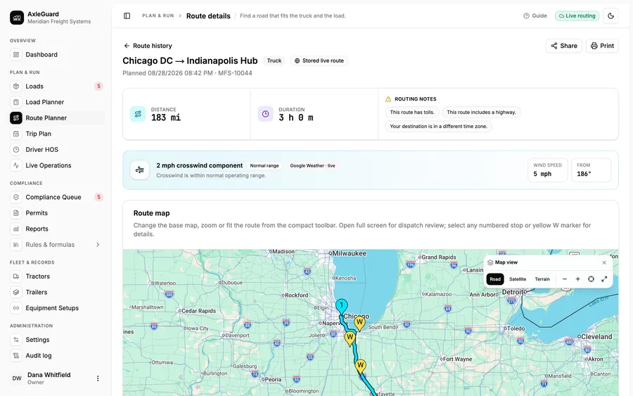
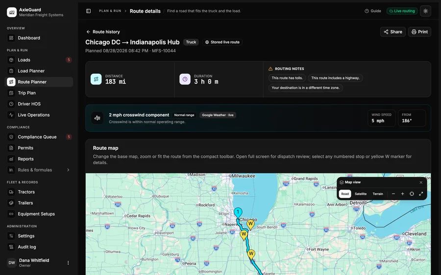
axleguard.app/routes
Our own route view. The road is only half of it — every leg carries its own axle verdict, because the freight aboard changes at every stop.
The platforms
Five names, and what each is genuinely good at.
Read what each one publishes. Where a vendor has not published something, we say so rather than filling the gap with a guess.
TomTom
Teams that want automotive-grade maps and traffic behind their own application.
What it does well
Long-established mapping and live traffic, built for vehicles rather than for people walking around a city. It publishes routing that takes vehicle parameters, so a road can be planned for something larger than a car, and its traffic data is genuinely good.
What it is not for
The commercial vehicle rows below are marked not published where we could not confirm the specific capability in the documentation as of August 2026. That is a statement about what we verified, not a claim about what the platform can or cannot do — check the current documentation before you rule anything in or out.
HERE Technologies
Product teams building commercial vehicle routing into their own software.
What it does well
A commercial vehicle road network with real depth behind it. HERE publishes truck routing that takes vehicle height, width, length, gross weight and weight per axle, applies hazardous material restrictions, and returns toll costs along the road it chose. If you are building routing for large vehicles, this is one of the two or three names on every shortlist for good reason.
What it is not for
It is road infrastructure, deliberately. It takes the weight figures you already know as inputs and gives you a road that respects them. It is not presented as a load-planning tool and does not claim to be one.
PTV Group
Planners optimising a whole day of work, not a single trip.
What it does well
PTV comes at this from logistics optimisation rather than from maps. Truck attribute routing, tour and fleet optimisation, arrival time forecasting, toll calculation, and a long history in European transport planning. If your problem is sequencing forty drops across eight vehicles, this is the category leader's category.
What it is not for
The optimisation sits one level above the axles. It decides which vehicle takes which stops in which order. What that freight does to the drive tandem once it is inside the trailer is not the question the optimiser is asked.
Trimble MAPS
North American carriers and brokers, in the office and in the cab.
What it does well
PC*Miler is the mileage of record for a large part of the North American freight industry. When a rate is agreed on a mileage figure, that figure very often came from here. Alongside it, CoPilot puts truck-legal turn-by-turn navigation in the cab with the vehicle profile applied, and the toll and hazardous route data is deep. Few products are as embedded in the day-to-day arithmetic of freight as this one.
What it is not for
Its subject is distance and road. Mileage, routing, tolls and navigation are what it publishes, and it publishes them thoroughly. Per-axle load distribution from cargo position is not part of that subject.
Azure Maps
Teams already inside Microsoft's cloud who want routing without leaving it.
What it does well
Azure Maps publishes a truck travel mode that accepts vehicle weight, weight per axle, height, width, length and a load type for hazardous cargo, and routes around restrictions accordingly. For a team already committed to that cloud, having competent commercial vehicle routing available with the same identity and billing is worth a great deal on its own.
What it is not for
Like the others in this category, it consumes an axle weight as an input. It has no view of the pallets that produced it.
Side by side
Thirteen capabilities, checked against published documentation.
The last four rows are the ones this page exists for. None of these platforms presents itself as a load-planning tool, so a no there is a description of scope and not a shortcoming.
Routing and navigation platforms compared with AxleGuard across thirteen capabilities
Capability
AxleGuard
TomTom
HERE
PTV Group
Trimble MAPS
Azure Maps
Vehicle height, width and length applied to the road
Yes
n/p
Yes
Yes
Yes
Yes
Vehicle gross weight applied to the road
Yes
n/p
Yes
Yes
Yes
Yes
Weight per axle accepted as a routing inputA number you must already know
Yes
n/p
Yes
n/p
n/p
Yes
Hazardous cargo road restrictions
part
n/p
Yes
Yes
Yes
Yes
Toll cost returned with the route
No
n/p
Yes
Yes
Yes
n/p
Mileage used as the figure of record for rating
No
n/p
n/p
n/p
Yes
n/p
Turn-by-turn navigation in the cab
No
Yes
Yes
Yes
Yes
n/p
Live traffic taken into account
No
Yes
Yes
Yes
Yes
Yes
Warning when a restriction had to be relaxed
Yes
n/p
n/p
n/p
n/p
n/p
Axle weights solved from where the freight sits
Yes
No
No
No
No
No
Bridge formula on every consecutive axle group
Yes
No
No
No
No
No
Corrective move in slider holes and inches
Yes
No
No
No
No
No
Axle verdict recomputed per leg as freight comes off
Yes
No
No
No
No
No
supportedpart partly, or with limits not supportedn/p not published by the vendor
How to read this table
Drawn from publicly published product documentation as of August 2026. Where a vendor has not published a capability the cell reads not published, which describes the documentation rather than the product. These platforms ship changes constantly — verify anything that matters with the vendor.
Where the category stops
A legal road and a legal load are two different answers.
You can be given a perfect road, follow it exactly, and be written up at the first scale on it. The road was never the thing that was wrong.
Weight arrives as one number
Every platform here takes gross weight, and two of them take a weight per axle. All of those figures are inputs. Nothing in the category derives them from the freight, because the freight is not something a road network has ever been shown.
The route does not know about stop two
A route with four drops on it is one road. The load on the trailer after drop two is a different load with different axle weights, and it may fail a rule the departing load passed comfortably.
There is no correction, because there is no cause
When a load is over, the useful output is not a verdict, it is an instruction. Move the tandems back four holes. A routing platform cannot produce that, because it never saw the pallets that caused it.
Capabilities published as supported, of 13
rows
AxleGuard8 rows
Plus one part, and four plain no
TomTom2 rows
Seven rows we could not confirm
HERE7 rows
Two rows not published
PTV Group6 rows
Three rows not published
Trimble MAPS7 rows
Two rows not published
Azure Maps5 rows
Four rows not published
Counted from the table above. A low count here is usually documentation we could not confirm rather than a capability the platform lacks, which is why every bar carries its not-published count beside it.
What the count does and does not tell you
The four rows at the bottom of that table are the ones this page exists for, and every platform is a no on all four. Nobody in this category presents itself as a load-planning tool, so those four are a description of scope rather than a weakness.
How this ends up working in practice
The load is solved first, axle by axle, against the jurisdictions on the route. Only a load that comes back legal gets a road planned for it, and each leg of that road is re-checked against the freight still aboard. Whatever your fleet uses for mileage of record and in-cab navigation carries on doing that job.
Head to head
Four specific comparisons in this category.
Each one covers who the product is for, the job it was not built for, and how the two work on the same load.
01Some of these accept an axle weight. Does that not solve it?
It solves the road, not the load. When a routing service takes a weight-per-axle parameter, it is asking you to tell it what each axle carries so it can keep you off a structure rated below that. It has no way to work the number out. If you type in the figure from the bill of lading divided by the number of axles, you will get a road planned for a truck that does not exist. The number has to come from somewhere, and that somewhere is the question this whole site is about.
02Do you replace the routing platform we already pay for?
Not necessarily, and often you should not want us to. If your rates are agreed on a particular mileage standard, that standard has to keep coming from where it comes from now. What changes is that the load going into the routing request has already been checked axle by axle, and the road that comes back is re-checked against the freight that is actually aboard for each leg.
03Why are so many cells marked not published rather than yes or no?
Because we only record what a vendor has written down publicly. Where we could not confirm documentation as of August 2026, marking it no would be a claim we cannot support, and marking it yes would be worse. Not published is the honest answer, and you should check the current documentation yourself before ruling anything in or out.
04Is the restriction-relaxed warning really unique?
We do not know that it is, and the table says not published rather than no for that row for exactly that reason. What we can say is what we do: when a fully compliant road cannot be found, that fact is put in front of the planner before the route is shown, rather than a road being returned that quietly ignores a restriction.
Next step
Bring a load your routing platform already cleared.
Same freight, same road, same jurisdiction. We will solve the axles for it and you can see whether the two answers agree. If they do, that is a good morning's reassurance.